|

Back Home

Ho Chi Minh Highway – A Bridge Connecting Quang Binh and Quang Tri

Central

Quang Binh

Sovaba.travel

Updated at: 28/08/2026

1. Ho Chi Minh Trail – The Trans-Vietnam Lifeline, a Road of History

"Hanging hammocks together in the Truong Son forest

Two of us at two far-away ends

The road to battle this season is so beautiful

Eastern Truong Son misses Western Truong Son."

There is a road etched with the footprints of tens of thousands of soldiers, a vital artery spanning the country where blood and bones were shed to write a heroic chapter of history – that is the Ho Chi Minh Trail, also known as the legendary Truong Son Road.  

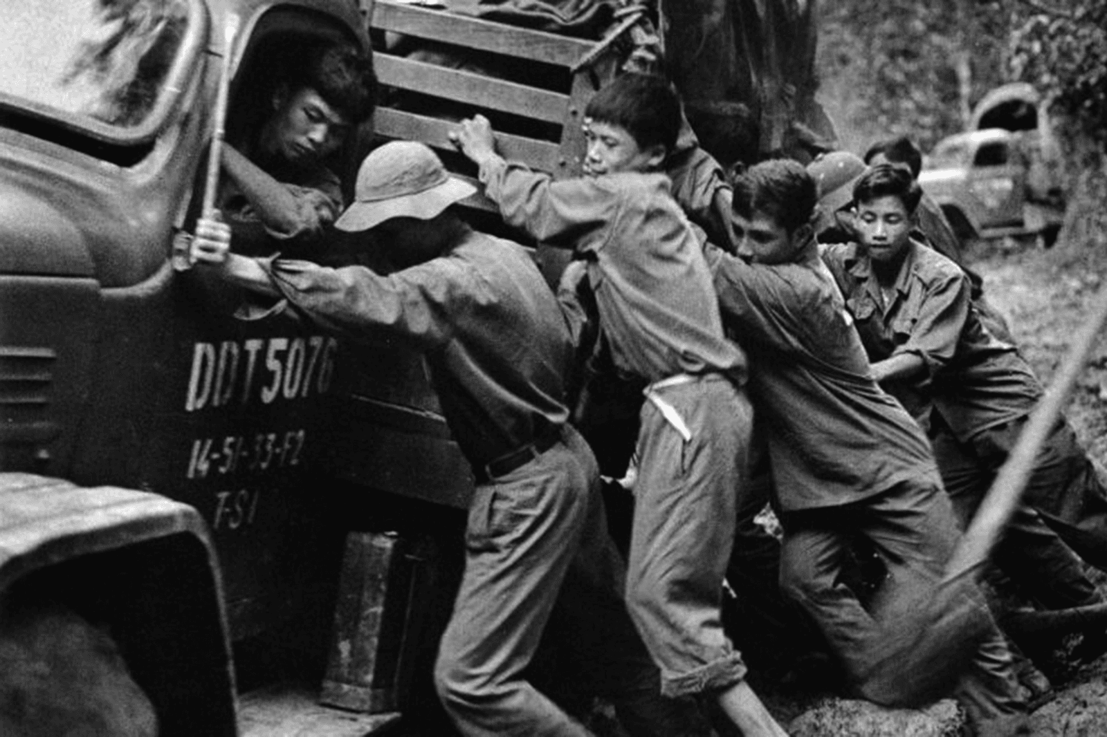
This strategic logistical route was not merely a military transport network, but also a lifeline connecting North and South, cutting through the rugged Truong Son mountains, traversing Central Vietnam, and extending into Lower Laos and Cambodia. For 16 years (1959 – 1975), this road served as the vital supply line for the Southern battlefield, delivering manpower, food, and weaponry to sustain the nation's long resistance war. The tireless footprints of the troops turned primitive trails into an increasingly complete transportation system, despite the devastating destruction from millions of tons of bombs, ammunition, and chemical defoliants dropped by the U.S. military and the Saigon regime.  

Ho-Chi-Minh-Trail-marking-every-historical-moment-of-the-country
Photo: Ho Chi Minh Trail - marking every historical moment of the country 

The Ho Chi Minh Trail was not only a road for the military, but also a symbol of resilient willpower and silent yet heroic sacrifice. Even as bombs churned the soil and toxic chemicals stripped the trees of leaves, human hearts still burned with fervor; the roads remained open, and troops kept marching for the desire for independence and national reunification.  

Today, traveling along the winding roads amidst the vast green forests of Truong Son and listening to stories of the fiery era, one truly appreciates the hardships endured by previous generations. The Ho Chi Minh Trail is not just a lifeline connecting the North and South, but a witness to history, a source of national pride, and a symbol of patriotism and the longing for peace and unification.
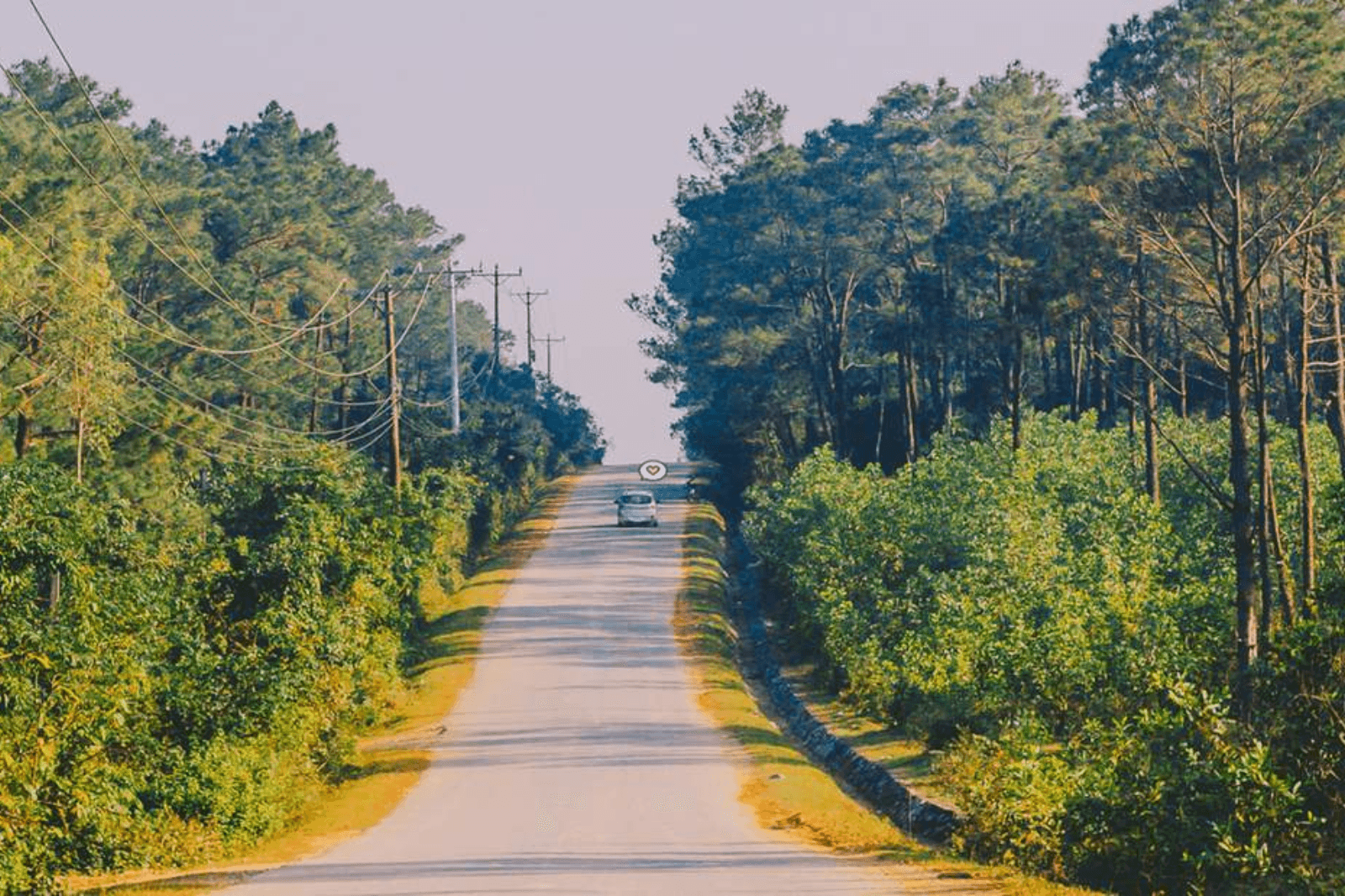
Ho-Chi-Minh-Trail-today-in-Quang-Binh
Photo: Ho Chi Minh Trail today in Quang Binh

2. History of the Ho Chi Minh Trail from Quang Binh through Quang Tri

After the 1954 Geneva Accords, Vietnam was temporarily divided into North and South. To ensure the Central Party's leadership over the revolutionary movement in the South, initially there was only a communication route through Western Quang Tri managed by Inter-region V Committee. However, facing the urgent demands of the resistance war, on May 19, 1959, the Standing Committee of the Central Military Commission tasked the 559th Transportation Group with opening the Truong Son Road – Ho Chi Minh Road to supply personnel and materiel to the Southern battlefield.  

This vital arterial route started from the western regions of Nghe An and Quang Binh, then shifted westward across the Truong Son range, passing through Quang Binh, Khammouane (Laos), and Savannakhet (Laos) before entering the Southern battlefield. The Ho Chi Minh Road through Quang Binh was not just a single road but a complex transport network winding through mountains and forests, closely following the natural terrain to proactively cope with all enemy bombardment tactics.  

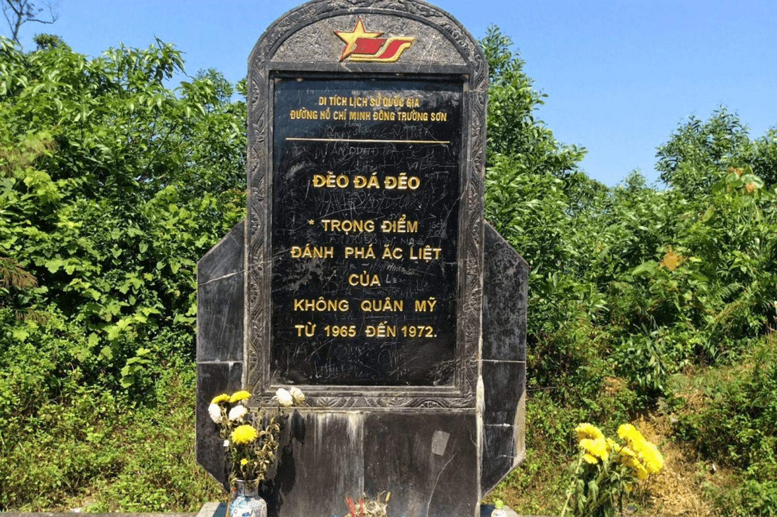
On the route from Quang Binh to Quang Tri, many locations became symbols of indomitable fighting spirit, such as the A-letter curve, Ta Le ford, Da Deo Pass, Pula Nhich Pass, Tra Ang ford, and Km20, which were once "fire points" enduring devastating bomb attacks aimed at destroying and severing the supply line from North to South. The enemy poured all their forces into continuous bombing, but with invincible determination, troops stayed day and night to repair and open paths, ensuring every supply shipment and troop unit continued moving toward the Southern battlefield.

Da-Deo-Pass-National-Relic
Photo: Da Deo Pass National Historical Relic

The Ho Chi Minh route through Quang Binh – Quang Tri witnessed the grand sacrifices of tens of thousands of soldiers and youth volunteers. Over 16 years (1959 – 1975), the U.S. military dropped millions of tons of bombs and sprayed Agent Orange to destroy life and cut off the supply line. Yet with patriotism and unyielding spirit, the children of Vietnam stood firm, clearing and repairing roads day and night to ensure troop columns and shipments kept advancing Southward.  

From initial pack and porter trails, the route gradually evolved into a system of liaison tracks, motorized roads, waterways, fuel pipelines, and even air supply routes, creating a solid and flexible transportation network. Thanks to the perseverance, creativity, and bravery of the people on this route, the South received vital reinforcements, contributing significantly to the victory of the resistance war against the U.S.  

Images-of-the-legendary-Ho-Chi-Minh-Trail
Photo: Images of the legendary Truong Son Road

3. The Ho Chi Minh Road Today: A Bridge of Development for Quang Binh and Quang Tri

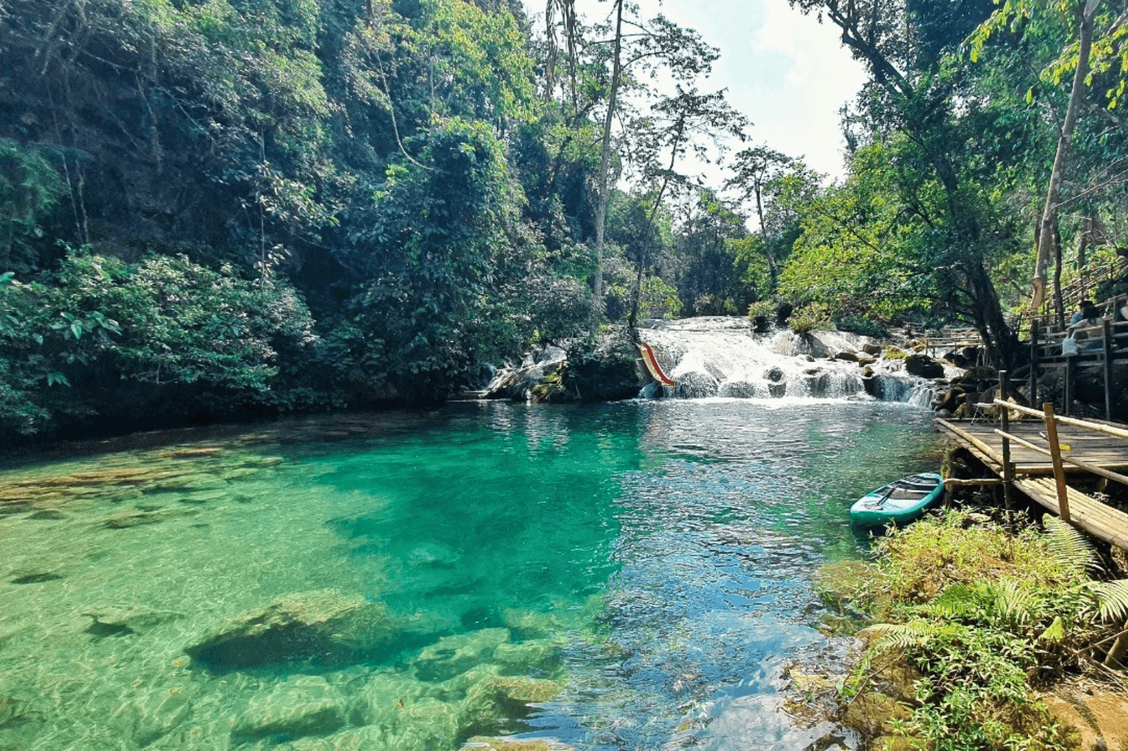
Today, the western area of Quang Binh and Quang Tri provinces stands out not only for its pristine natural beauty but also attracts visitors with its unique historical and cultural values alongside exciting experiential tourism activities. Destinations such as Cha Cung - Cha Rao Stream (Truong Son Commune, Quang Binh), Cha Loi Cave (Ngan Thuy, Quang Binh), Ta Puong Waterfall, and Cu Vo Hill (Quang Tri) offer great tourism development potential for Quang Binh - Quang Tri. In addition, Ho Rum and Chenh Venh villages (Quang Binh) are tourist spots where visitors can immerse themselves in community life and discover the distinctive cultures of ethnic minorities. Notably, the Western branch of the Ho Chi Minh Highway is becoming an ideal route for international tourists passionate about motorbike adventures heading to Phong Nha, offering an exhilarating journey of discovery amidst the Truong Son mountains.  

Cha-Cung-Cha-Rao-Stream
Photo: Cha Cung - Cha Rao Stream

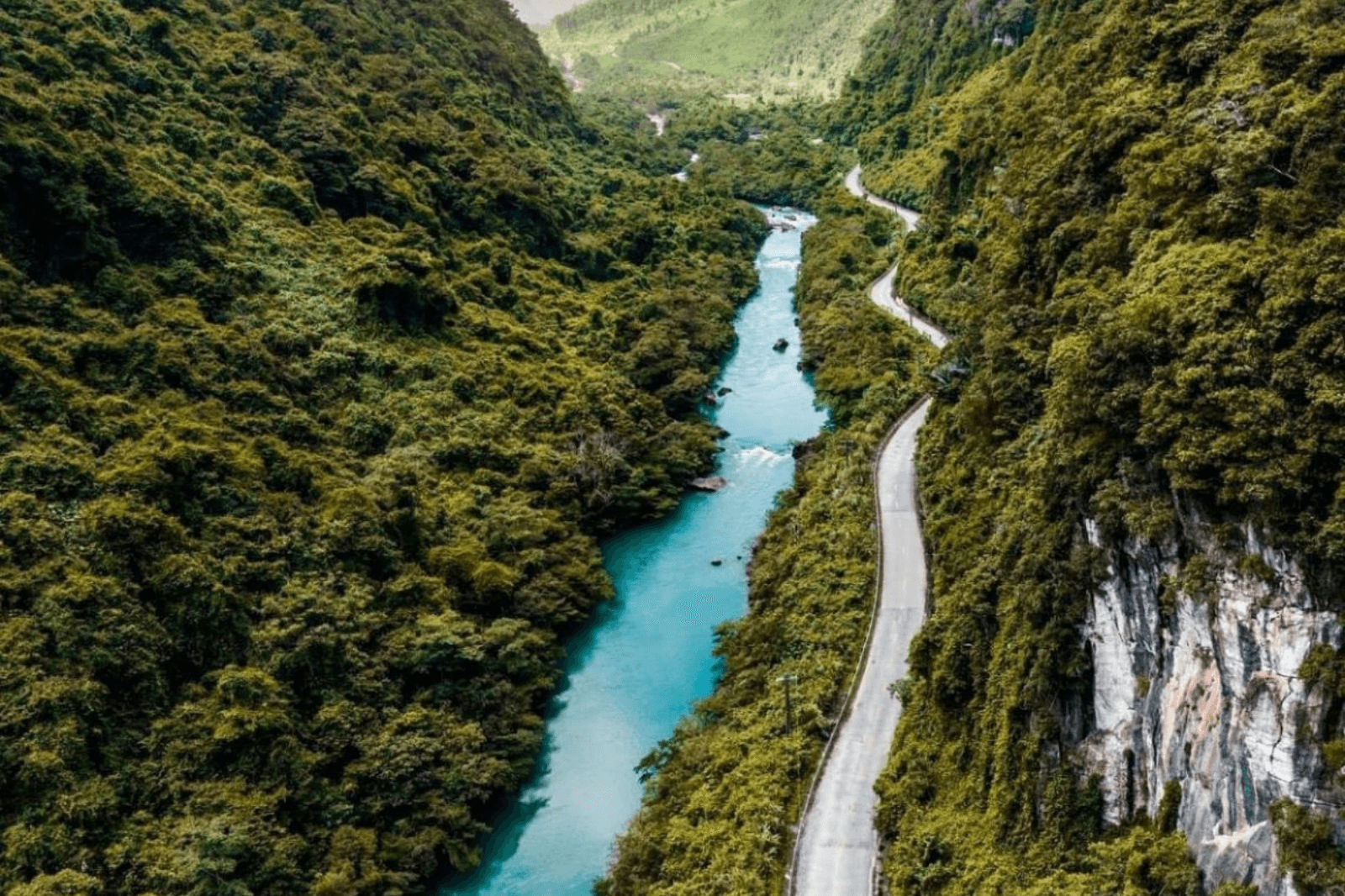
Once a strategic lifeline during the war, today the Ho Chi Minh Highway from Quang Binh to Quang Tri continues to affirm its vital role in transport, economic, and tourism development. With upgraded and expanded infrastructure, this route has become an important traffic axis connecting Central provinces, facilitating trade between the lowlands and mountainous regions. Lands that once buckled under war smoke have now experienced strong revival, giving local people access to a dynamic economy, improving living standards, and boosting production.  

Ho-Chi-Minh-Highway-connecting-Quang-Binh-and-Quang-Tri-today
Photo: Ho Chi Minh Highway connecting Quang Binh - Quang Tri today

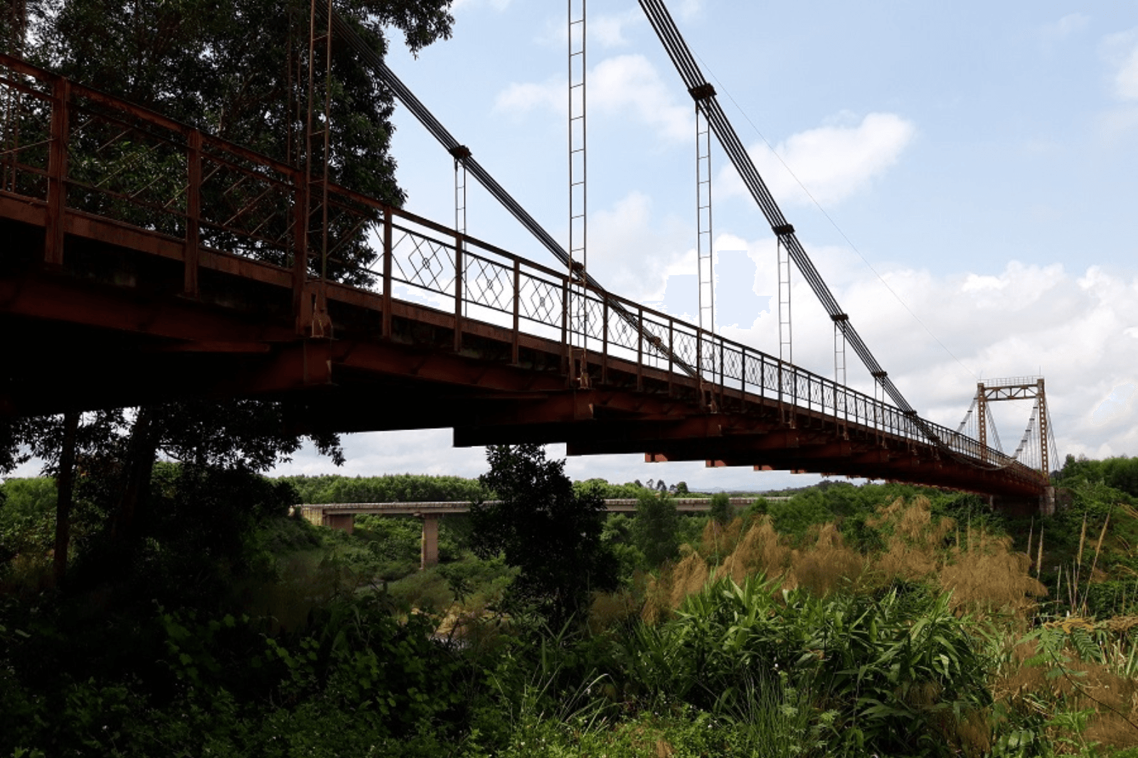
The vast Truong Son forests, majestic mountain passes, and heroic historical sites such as Khe Ho, Ben Tat Suspension Bridge, and Quang Tri Ancient Citadel are gradually becoming attractive destinations for domestic and international travelers. The combination of untouched nature and heroic history not only offers memorable experiences but also contributes to preserving traditional values and promoting sustainable development for the region.  

Ben-Tat-suspension-bridge-relic
Photo: Ben Tat suspension bridge relic 

The Ho Chi Minh Highway from Quang Binh through Quang Tri is not just a road of history, but also a bridge for development, bringing profound transformation to a land that once endured the heavy weight of war. The miraculous revival of this region demonstrates not only the vibrant vitality of nature, but also stands as proof of human resilience and determination to rise. A journey back to Truong Son today is not just a scenic excursion, but an opportunity for everyone to listen to stories of the past, expressing gratitude and cherishing the values of peace.

Loading......

Featured destinations