Pa Thien - Voi Mep: Conquering the 'Roof of Quang Tri' and the Legendary Sea of Clouds

Central

Quang Tri

Sovaba.travel

Updated at: 24/09/2026

1. Where is Pa Thien – Voi Mep Peak?

Pa Thien and Voi Mep peaks, two side-by-side masterpieces, are strategically located in the South Quang Tri Special Use Forest (formerly North Huong Hoa Nature Reserve). These two majestic mountains are an inseparable part of the Southern Annamite Range (Truong Son Nam) and lie close to the Vietnam–Laos border (opposite Sepon District, Salavan Province).

Exact Geographical Location

  • Located in Huong Phung Commune, Quang Tri Province.
  • Travel distance:
    • ~85 km from Dong Ha City (about 2 hours 30 minutes by car).
    • ~35 km from Khe Sanh.

According to a 2023 survey by Bach Ma National Park, Pa Thien was recorded as the only point in Quang Tri with subtropical flora, highlighted by over 120 wild orchid species, including Paphiopedilum delenatii – a rare slipper orchid. 
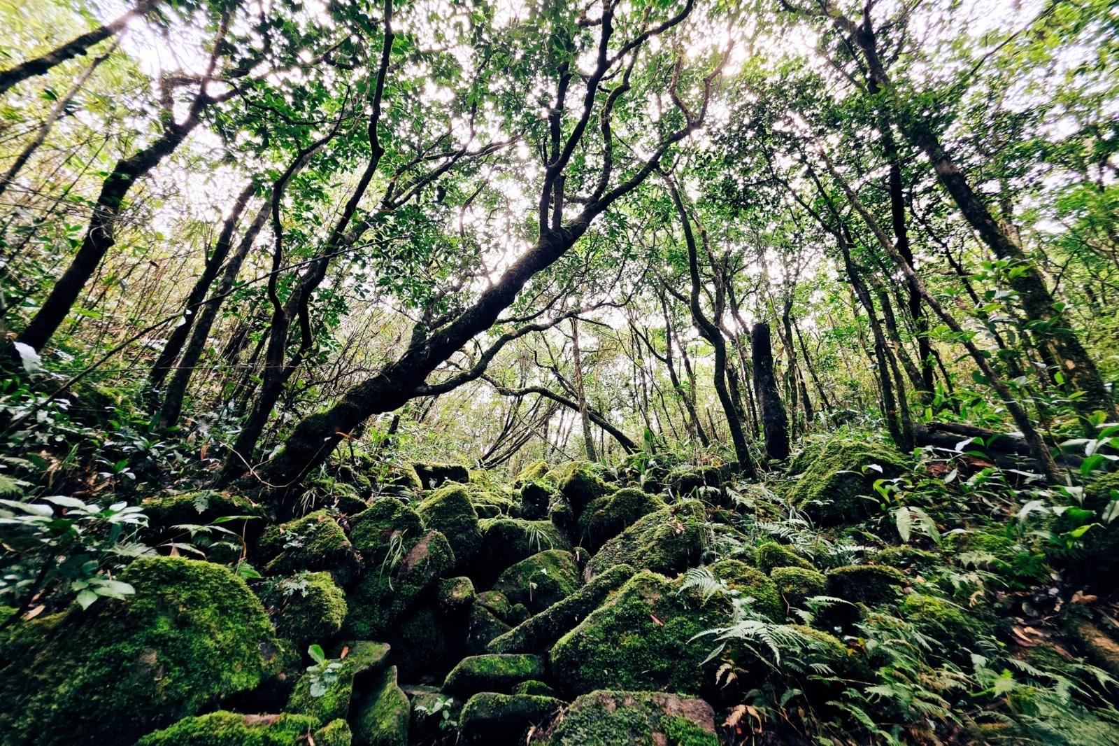
Primary forest on Pa Thien - Voi Mep peak
Photo: Primary forest on Pa Thien - Voi Mep peak 

2. The majestic height of the two mountain peaks

Pa Thien – Voi Mep conquers visitors not only with its beauty, but also with its impressive elevation:

  • Pa Thien: Stands at an altitude of approximately 1,625 m.
  • Voi Mep: Reaches an elevation of over 1,700 m, officially becoming the highest peak in Quang Tri Province.

It is this impressive altitude that has created an extraordinarily valuable ecosystem:

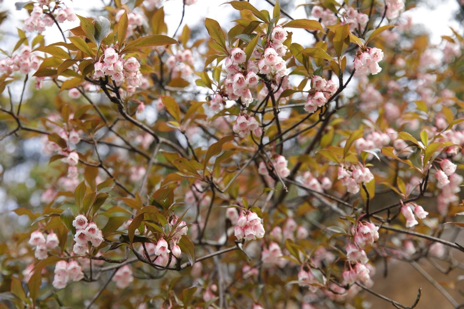
From an altitude of 1,200 m and above, you will enter a subtropical moist evergreen closed forest with a canopy cover of over 90%. This is the realm of precious timber trees such as Fujian cypress (Po mu), Ironwood (Lim xanh), Yew (Thong do), and especially Rhododendrons with vibrant red bell-blossoms around February – March. 

Wildflowers on Pa Thien mountain peak
Photo: Wildflowers on Pa Thien mountain peak 

This area is known as a "cloud forest", where fog and clouds cover the landscape year-round, playing a crucial role as the headwaters of the A Cooc stream, which flows into the Sepon River. This not only creates a magical landscape but also provides a clean, stable water source for about 15,000 local residents. Conquering this trail is not just about trekking, but also touching a biological treasure and the lifeline of Quang Tri.

3. The experience of conquering Pa Thien - Voi Mep Peak

The journey to conquer Pa Thien – Voi Mep, the proud "roof" of Quang Tri, is an inspiring and challenging trekking experience. The trail to Voi Mep peak is famous for its winding, steep, and tough sections, requiring thorough physical preparation.

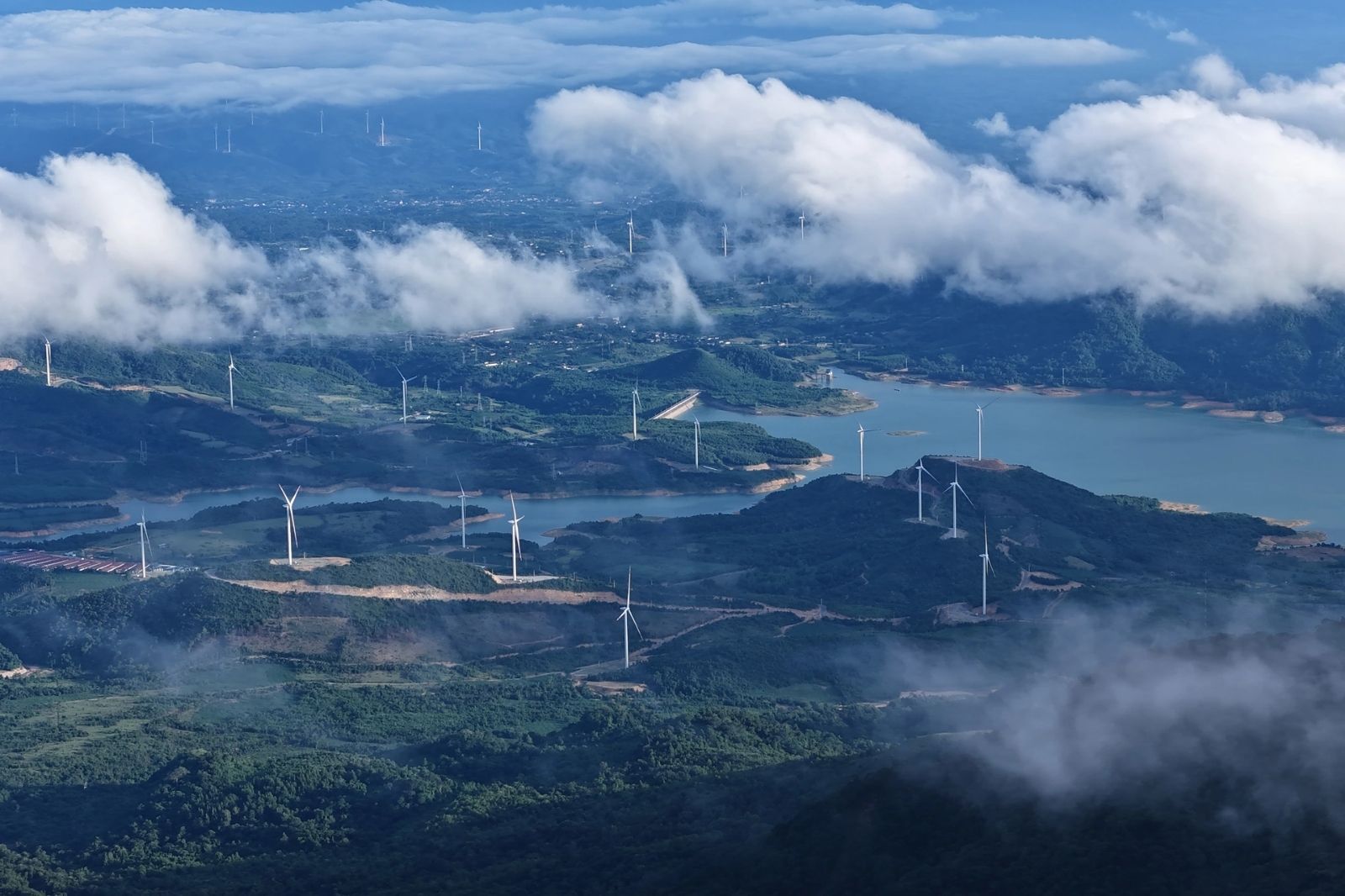
Viewing wind farms along the trekking journey
Photo: Viewing wind farms along the trekking journey

With a total length of nearly 9 km, every step along the way brings a surprising discovery. Trekkers will pass majestic rock fields such as the rocking boulder field or new rock fields, admire the romantic beauty of seasonally blooming rhododendrons and bell-blossom flowers, and experience trekking through dense, lush green bamboo forests. Beyond immersing in nature, you will also admire the spectacular sight of wind farms stretching across the valley, a unique blend of nature and modern development.

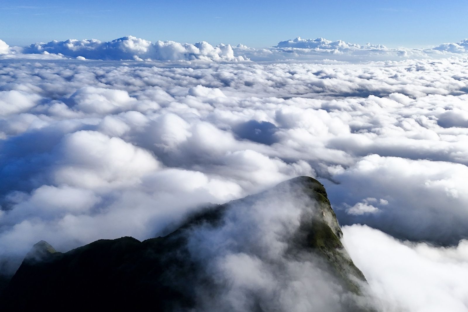
The ultimate reward for perseverance is a one-of-a-kind "cloud hunting" scene. Standing atop Voi Mep peak, you will behold a sea of clouds rolling like ocean waves, blanketing the mountains and forests below, creating a sense of overwhelming awe and total freedom. This place feels completely detached from the world below, shrouded in mist and clouds all year round, turning Pa Thien – Voi Mep into a trekking paradise that every travel enthusiast longs to reach.

White clouds cover the mountain peak year-round
Photo: White clouds cover the mountain peak year-round 

4. Traveling to Pa Thien - Voi Mep Peak

Currently, the eco-tourism potential of Pa Thien – Voi Mep has been systematically researched and developed. Relevant authorities have completed necessary procedures, documentation, and surveys, aiming to officially construct a trial operation project for the Pa Thien – Voi Mep trekking tour.

This tourism product is designed with two diverse itineraries, catering to the needs and physical fitness levels of various visitors:

  • 2-Day 1-Night Itinerary: With a total length of approximately 6.5 km, this is an ideal choice for beginners or those with limited time, while still ensuring the cloud-hunting experience and cloud forest exploration.
  • 3-Day 2-Night Itinerary: A longer route of over 8.8 km, designed for true trekking enthusiasts who wish to spend more time exploring the valuable ecosystem and fully enjoying the majestic, wild beauty of the area.

Standardizing these trekking routes promises to establish Pa Thien – Voi Mep as a leading eco- and adventure-tourism destination in Quang Tri.

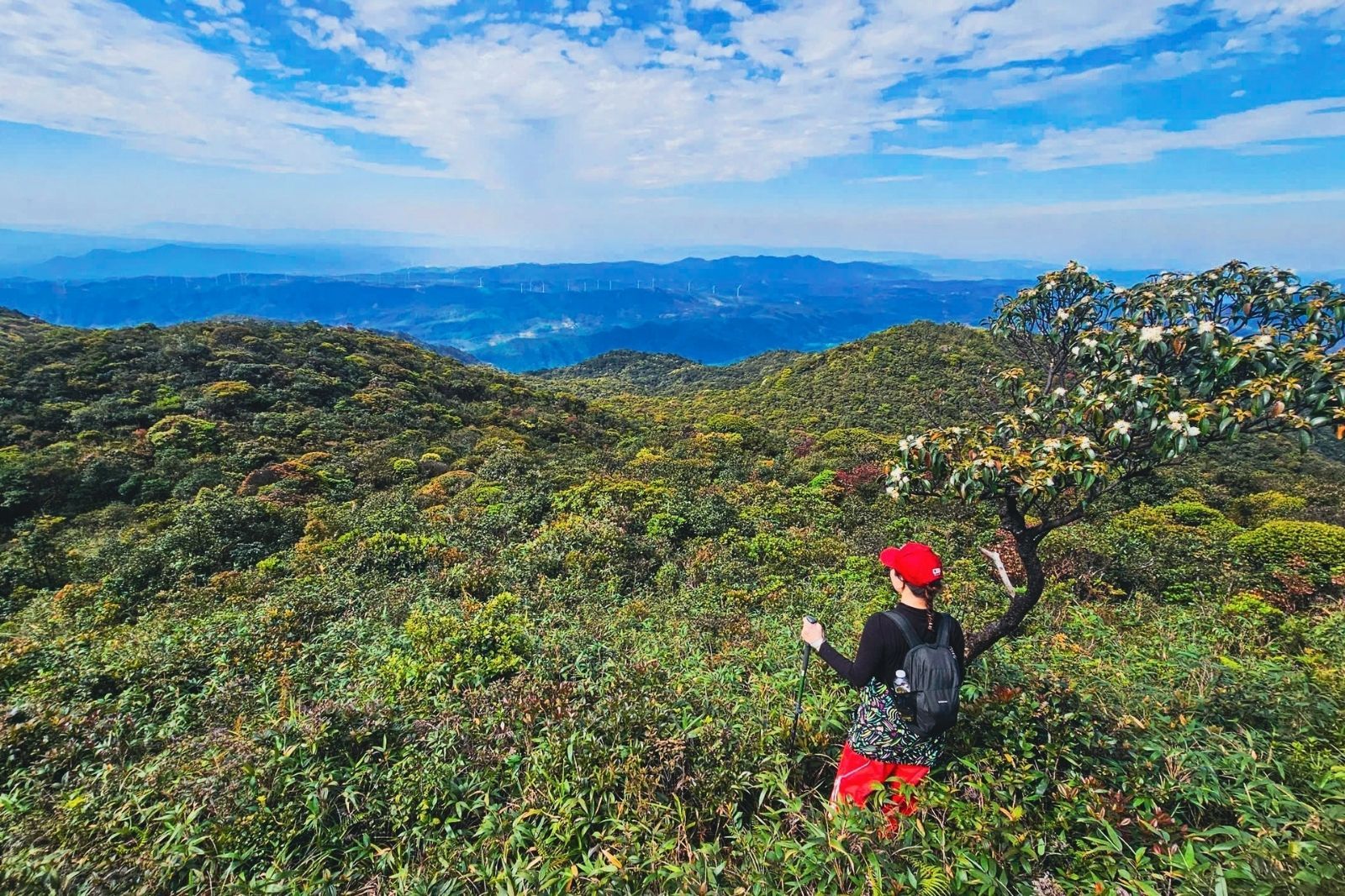
Trekking tour currently undergoing trial research
Photo: Trekking tour currently undergoing trial research 

Known as the "roof of Quang Tri", Pa Thien – Voi Mep not only conquers the hearts of trekking lovers with spectacular mountain trail challenges, but also opens up a pristine world where a legendary sea of clouds rolls between earth and sky. Standing on the mountain peak, you will not only behold majestic landscapes but also deeply feel the cultural breath of the Pa Ko ethnic group, unique ecological value, and a peaceful tranquility that cleanses the soul. This journey thus becomes an experience far beyond mere travel. To prepare thoroughly for your trip and gather more useful Quang Tri travel tips, you can visit sovaba.travel

Loading......

Featured destinations