The Hoi An travel map is an indispensable guide to exploring this city with ease. Hoi An is located in the downstream area of the Thu Bon River, Quang Nam Province (now Da Nang City). The central area is the Ancient Town, with main streets such as Tran Phu, Nguyen Thai Hoc, Le Loi, and Bach Dang running along the Hoai River. Satellite maps from Google Maps help you navigate quickly, especially when traveling by bicycle or motorbike – popular modes of transport here to avoid traffic jams and enjoy the peaceful atmosphere.
Here are some detailed maps for your reference:
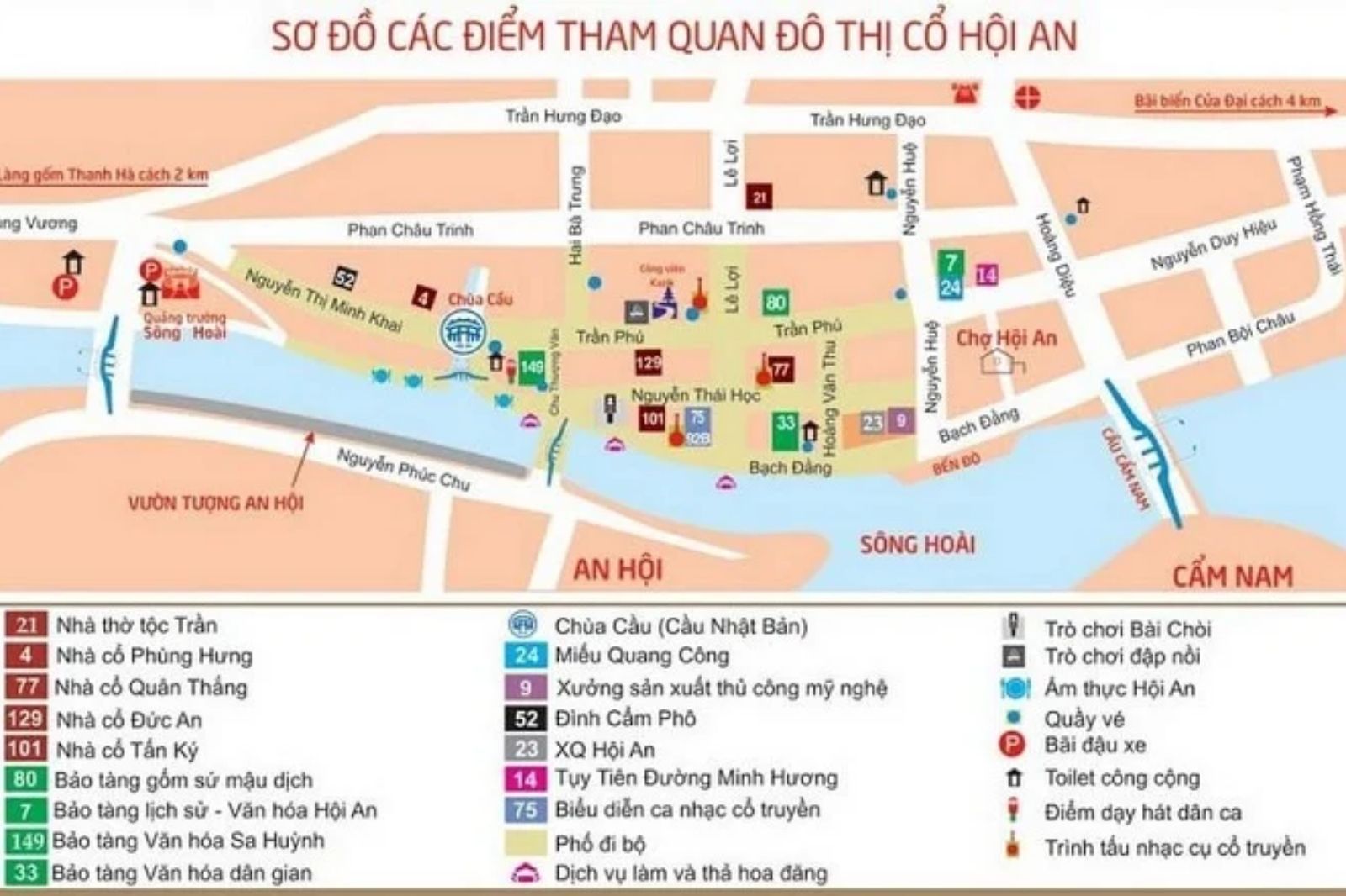
This map shows the main attractions in the ancient town, including Cau Temple Bridge, Quan Cong Temple (No. 24), and assembly halls such as the Fujian Assembly Hall (No. 46). The Hoai River area lies in the middle, lined with boat docks and night markets. If you use the Google Maps app, switch on "satellite" mode to view the waterways and surrounding craft villages like Thanh Ha Pottery Village (2km west of the center).
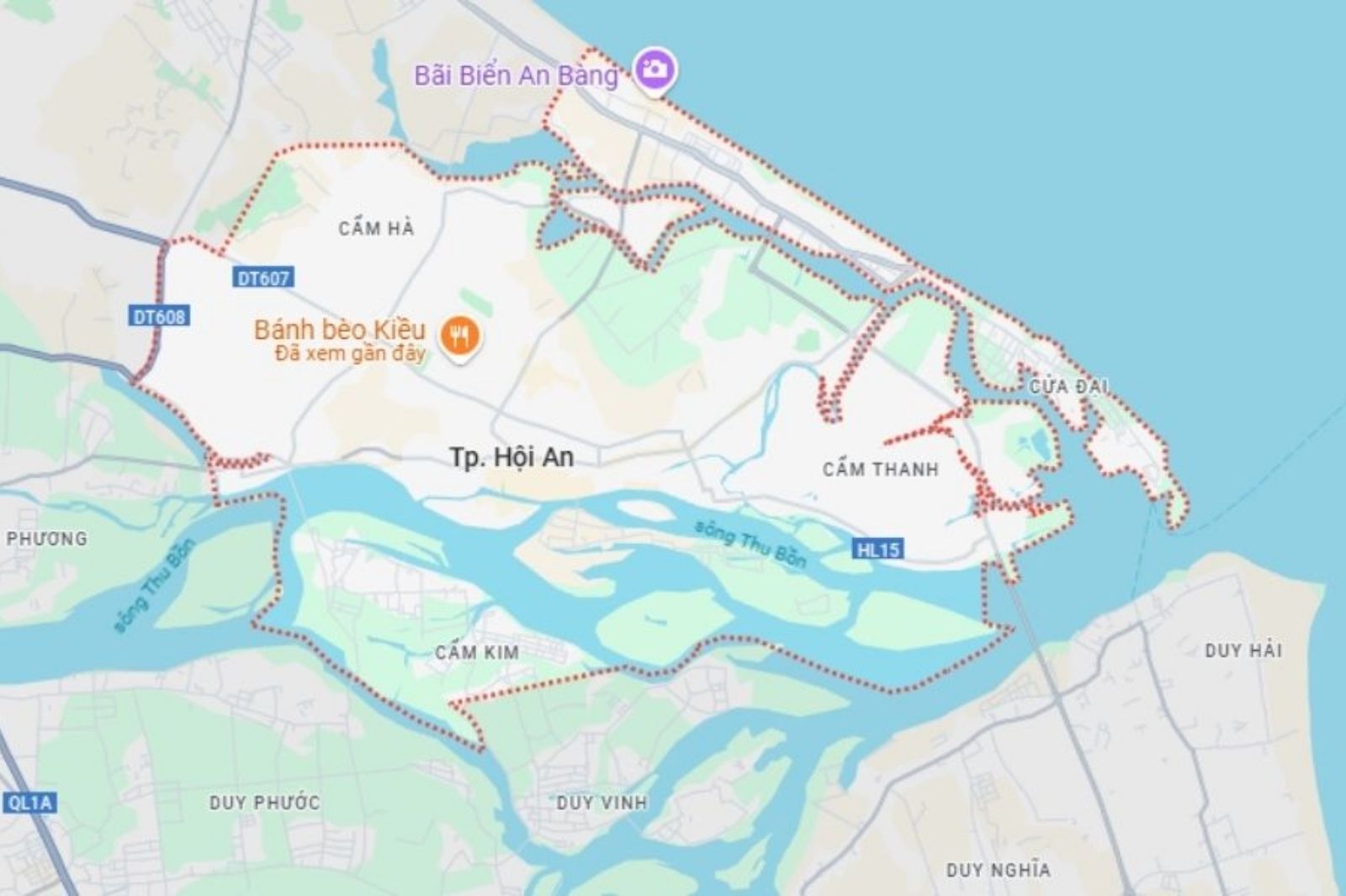
The satellite map of the entire city shows that Hoi An borders the East Sea, with beaches such as An Bang (to the North) and Cua Dai (to the East). The Cam Thanh area with the Bay Mau Coconut Forest is located in the South, ideal for basket boat tours. In 2026, the map has been updated with new routes connecting to VinWonders Nam Hoi An, making it easier for visitors to travel by bus or Grab.
To use the map effectively:
- Download the Google Maps or Maps.me app (supports offline mode).
- Bookmark attractions by theme: heritage (ancient town), nature (beaches, craft villages), entertainment (theme parks).
- Note: Motorbikes are prohibited in the Ancient Town from 9:00–11:00 and 15:00–21:00 daily to preserve the heritage.